2016 Walker's Programme
Date |
Rendezvous |
Footpaths |
Sunday 17 January
|
|
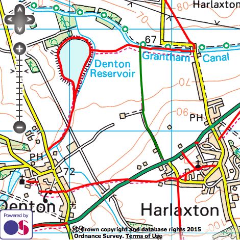
Sunday 21 February
|
|
|
Sunday 20 March
Starting at Orston (suggest parking on the roads near the pub), the walk takes us along the River Smite to Aslockton, then off to Thoroton before returning to Orston for lunch at the Durham Ox. |
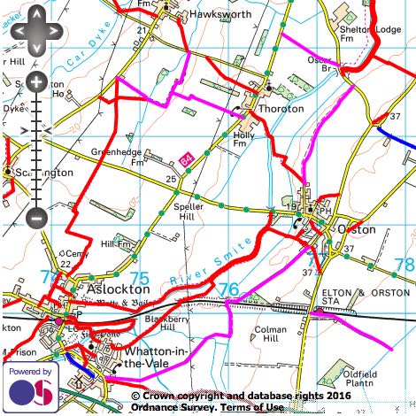
|
|
Sunday 17 April
Starting at Harby, car sharing is recommended, the circular route of about 4.5 miles is mainly on level ground. Returning to the Nags Head for lunch. |
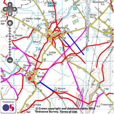
|
|
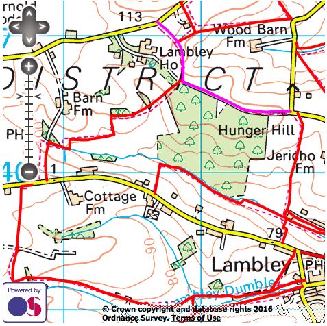
Sunday 15 May
Starting at the car park of The Lambley Village Kitchen on Main Street, the 5m circular walk along footpaths and rolling countryside returns to Lambley for lunch. |
|
|
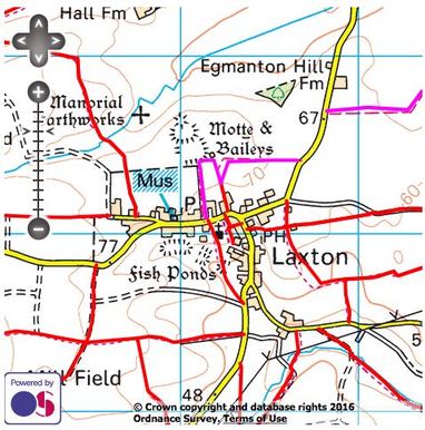
Sunday 19 June
A joint visit with the Gardening and Wine Groups. Walk around Laxton, lunch at The Dovecote, in Laxton, followed by a visit to NGS garden at Ossington, £4 entry |
|
|
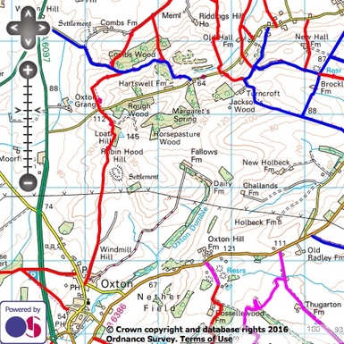
Sunday 17 July
Starting at the Green Dragon car park, the 5 mile walk follows the track northwards past Robin Hood Hill, then circles to the right along part of the Robin Hood Trail before retracing our steps at Robin Hood Hill back to Oxton for lunch at Ye Olde Bridge Inn. |
|
|
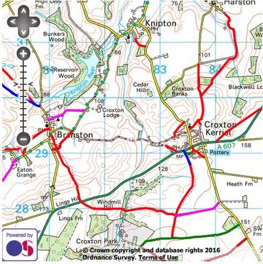
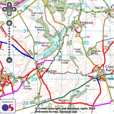
Sunday 21 August
A circular route from Branston to Eaton and back. Meet for a 10.30am start as usual by the Wheel pub in Branston village, NG32 1RU followed by lunch at the 'Geese and Fountain' in Croxton Kerrial. |
|
|
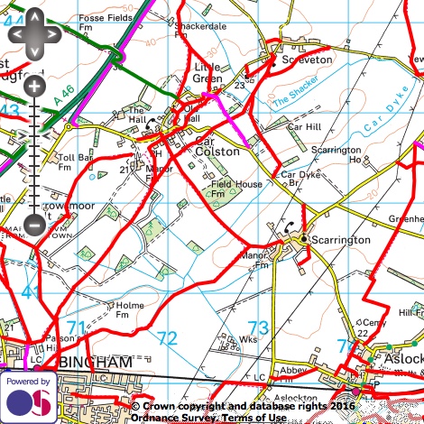
Sunday 18 September
Meeting at the 'Royal Oak' car park at Car Colston near Bingham for a 10.30 start, the walk follows public rights of way over gently rolling farmland, past Scarrington and returning to the pub for lunch. |
|
|
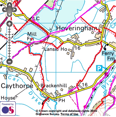
Sunday 16 October
Meeting at the 'Black Horse' car park at Caythorpe (NG14 7 EB) for a 10.30 start, the walk follows public rights of way over gently rolling farmland, past Caythorpe Mill and through Hoveringham before returning to the pub. Lunch will be nearby at the 'Old Volunteer' Caythorpe. |
|
Sunday 20 November
|

|
Sunday 18 December
|
|
Followed by Sundays in 2017 to be published
Credits and Small Print
Published under the Ordnance Survey Public Sector Mapping Agreement licence 100053366. The walking maps on this web page have been generated by www.rowmaps.com. The underlying map is provided by OS OpenSpace and this is © Crown copyright and database rights 2016 Ordnance Survey. Data containing details of the rights of way have been released under licence by the councils of, Derbyshire, Leicestershire, Lincolnshire, North Lincolnshire, Nottingham (City of), Nottinghamshire. An authority's Definitive Map is the authoritative source of their rights of way. The details of the public rights of way network contained in an authority's data are for information only, and are an interpretation of the Definitive Map, not the Definitive Map itself, and should not be relied on for determining the position or alignment of any public right of way. For legal purposes, an authority's data does not replace their Definitive Map. And changes may have been made to the Definitive Map that are not included in their data. The authority's data contains Ordnance Survey data © Crown copyright and database right 2016. Attempting to view this data with more detail than 1:10000 may produce an inaccurate rendering of the route of a public right of way. This data is used to generate the coloured lines. The following colours are used for the coloured lines:
solid red line: footpath;
solid fuchsia line: bridleway;
solid green line: restricted byway;
solid blue line: byway open to all traffic.