2014 Walker's Programme
Date |
Rendezvous |
Footpaths |
|
Sunday
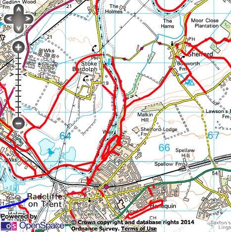
19 January Shelford, Radcliffe on Trent Lunch at the Earl of Shelford, Shelford |
|
|
Sunday
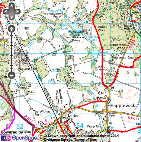
16 February Linby, Newstead Abbey, Papplewick Lunch at the Griffin's Head, Papplewick |
|
|
Sunday
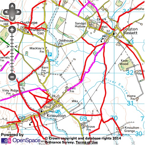
16 March Kinoulton, Colston Basset Lunch at the Nevile Arms, Kinoulton |
|
|
Sunday
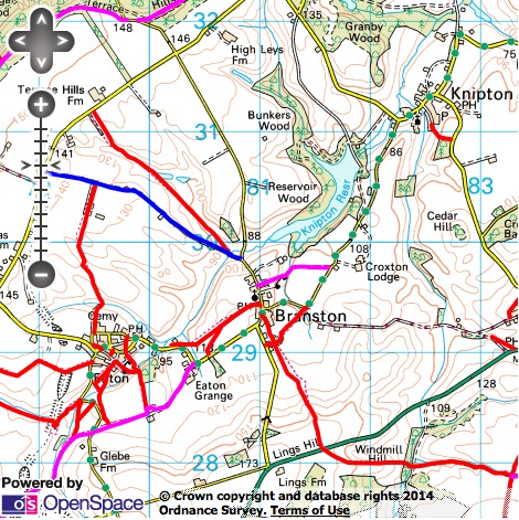
27 April Branston, Eaton Lunch at The Wheel Inn, Branston |
|
|
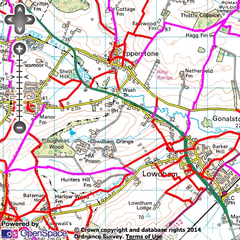
Sunday
18 May Lowdham, Epperstone, Hagg Farm Lunch at The Old Ship Inn, Lowdham |
|
|
|
|
|
|
|
Sunday
16 November Lowdham, Epperstone, Gonalston Lunch at The Old Ship Inn, Lowdham |

|
|
Sunday
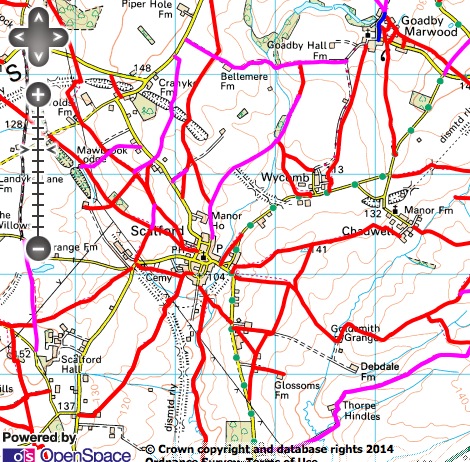
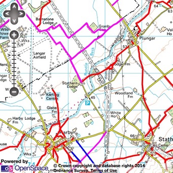
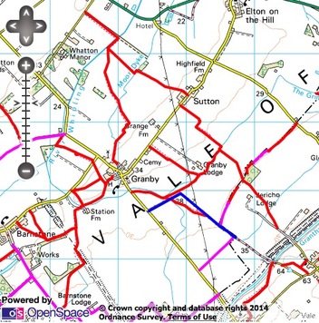
21 December Granby |
|
Credits and Small Print
The walking maps on this web page have been generated by www.rowmaps.com. The underlying map is provided by OS OpenSpace and this is © Crown copyright and database rights 2014 Ordnance Survey. Data containing details of the rights of way have been released under licence by the councils of, Derbyshire, Leicestershire, Lincolnshire, North Lincolnshire, Nottingham (City of), Nottinghamshire. An authority's Definitive Map is the authoritative source of their rights of way. The details of the public rights of way network contained in an authority's data are for information only, and are an interpretation of the Definitive Map, not the Definitive Map itself, and should not be relied on for determining the position or alignment of any public right of way. For legal purposes, an authority's data does not replace their Definitive Map. And changes may have been made to the Definitive Map that are not included in their data. The authority's data contains Ordnance Survey data © Crown copyright and database right 2014. Attempting to view this data with more detail than 1:10000 may produce an inaccurate rendering of the route of a public right of way. This data is used to generate the coloured lines. The following colours are used for the coloured lines:
solid red line: footpath;
solid fuchsia line: bridleway;
solid green line: restricted byway;
solid blue line: byway open to all traffic.